Hi Traindude,
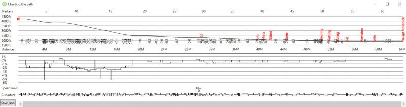
your screenshot leaves me a bit puzzled: the track viewer from Open Rails 1.5.1 doesn't activate the option "Show Chart" without selecting a path first, and after I've selected a path then it will display that path's name in the title bar where your screenshot only says "Charting the path". Could it be that you are using an older or newer version of track editor?
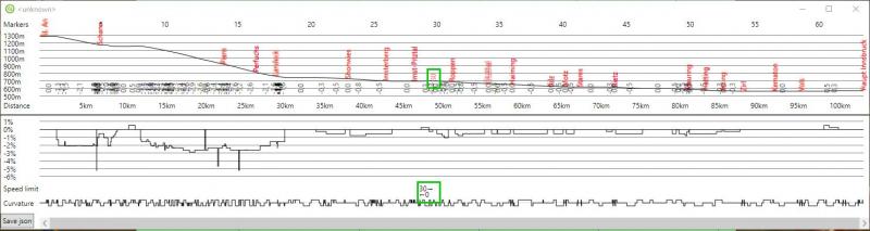
So, as Weter already mentioned we have no clue which path you might have chosen for your chart. Then I thought that you might be charting a completely new path without any name given yet, but if I try that I get "<unknown>" in the title bar, and the station names are still displayed correctly, see my screenshot below. Could you please tell us for which path you created the chart from your screenshot?
About the speed limit: I see the same speeds indicated as you, regardless which path I've loaded. I haven't run any activity yet on this route, but my guess would be that "0" means "no restriction", not "0 MPH".
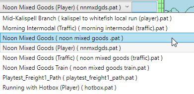
You also mentioned a missing path on Marias Pass. I get four different ones - which one is missing from your installation?
Greetings, Peter
 Log In
 Register Now!
 Help
Help