Posted 15 March 2011 - 10:58 AM
A couple of thoughts:
Not long after I first began recreating an historical route, I ended up visiting a handful of local historical societies in the Minnesota iron ranges, looking for photos, maps, and manuscripts. At times I would bring my laptop and demonstrate the route in progress to the curators or volunteers. When I could show them what the simulation looked like (crude as it was or is), they wondered if it wouldn't make a pretty good exhibit. So what David calls and absurdity is for a museum exhibit spot on for other purposes. It would be real time presentation of the ore train and route which might be booted up in the morning and (if the activity could swap cabs) run for four hours southbound with a loaded ore train, and return northbound for four hours with empty ore cars).
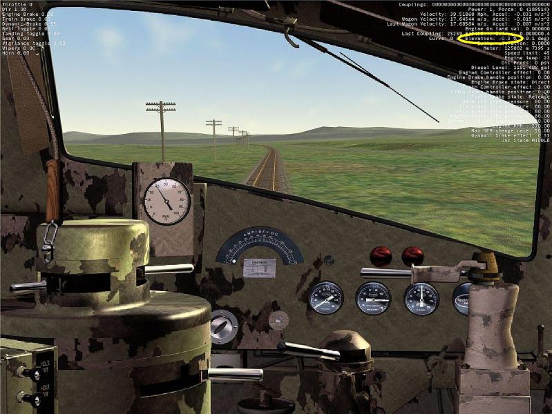
With OR and wide screen higher resolution monitors, we have a lot more screen "real estate" to give optional information to whoever is sitting at the console. Most routes that can be bought or freely downloaded have pretty crude documentation, whether track schematics (showing switches, yards, side tracks, and structures), or track gradient profiles. As a simulation progresses, there isn't a lot of information to inform the operator "where am I" or "what is ahead". MSTS cabviews are challenging to create and as they try to show a live view of the track ahead plus the whole cab and controls, end up with dials and readouts that are too small to read easily.
Things that I can imagine:
* A pop up birds eye view, based on Google maps that show the train length centered on the surrounding map features
* A condensed track profile that can be dropped down from the top of the window showing the full length of the train and the next (some number of) miles or kilometers ahead (and the corresponding gradient)
* A fly out display from the side of the window that presents an array of standard and essential gauges (nice brass look for Steam Locos, Diesel era dials for later locomotives, Digital readouts for modern era equipment). Such a fly-out display can leave in place most of the view forward seen by the engineer.
A comment on gradients. When I am driving from my home in Minneapolis to our family cabin in the iron range I often set up my Garmin GPS to display a profile of the elevation along the route. Often I compare that with what I am seeing out the window. I realize that it not easy to be sure whether the road is level (rather rare) or is gradually climbing or descending. Our simulator view is even more crude than out the windshield view. A simple report of gradient (is easy to calculate (and even easier to ignore). Yes, I suppose there are other implicit gradient clues from engine performance or "slack" or "bunch" data values, and speed changes. What the heck, even the water level gauge in a steam locomotive cab I suppose can crudely approximate an gradient indicator.
I've never ridden in a cab, but I can imagine there are many informative sensations engineers and conductors hear and feel that OR and MSTS don't present. If we can give simulation operators visual clues to replace what being in the cab provides, well, so much the better.
 Log In
 Register Now!
 Help
Help


 thegrindre, on 12 March 2011 - 12:13 AM, said: