 Log In
 Register Now!
 Help
Help


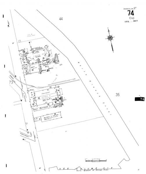
As the primary customer for the maps was Fire Departments the drawing includes all sorts of information they'd want to know and not so much we want... but there is enough to use. What I do is enlarge the original map and then copy the portion I want to markup. I'll erase details I don't need, such as the type of fire alarms present (heavy circles with letters within), the location of fire hoses and chemical carts, interior doors (double lined arc), and the location of fire hydrants (big black dot with DH) and water lines (a run of equal signs). Having cleared all that out, I then markup what's left:
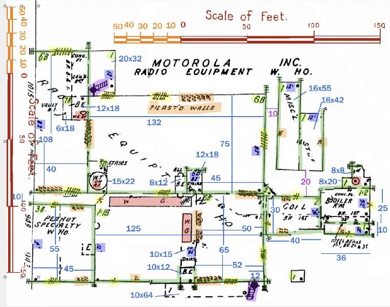
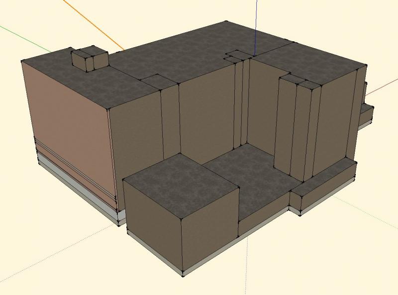
Using highlighter colors in my paint program, I mark height to roof (blue squares), features on the roof (red), locations of windows (yellow), anything I can find that tells me something about the walls (orange), how many floors in the building (light green circles) and locations of firewalls/parapets (medium green lines). Then I paste in as floating objects a couple of rules I've made (the originals are on every page of the Sanborn maps) and by moving them around I can figure out a pretty good estimate of the dimensions of the building (medium blue lines and numbers). From all of that I can build a model that will have the basic size and form of the original. Here's a quickie 1st version:
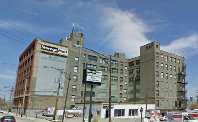
The Sanborn maps do not provide much -- if any -- information about windows, doors, color of brick or painted wood and so for that I can hope the building still stands and that google maps will show it to me... or I just have to use my imagination. In this case, I get lucky and find some images:
In the final model I'll include some number of details that will help the model mimic the original.