Log In
 Register Now!
 Help
Help


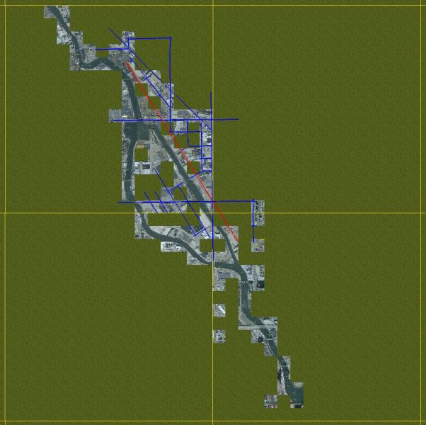
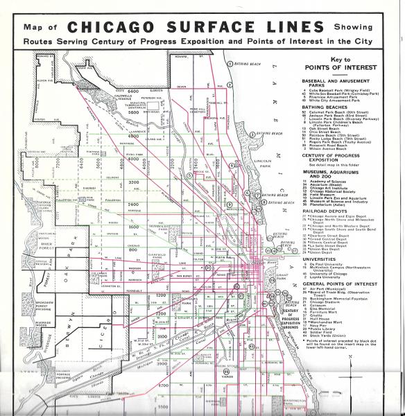
Goose island is a small, man made island on the north branch of the Chicago River, just a couple of miles NW of downtown. It's 1 mile long and at its widest, less than 1/3 of a mile wide. The Milwaukee Road had a small yard there and did switching on the island and along the east side of the river, a run of less than 4 miles total (less than a mile to the south of the island, not quite 2 miles going to the north), with the island in the center. Along the west shore are more industries and the 5-8 track mainline of the C&NW. The MILW had only a couple of customers in this area. Like all of Chicago, it's FLAT and pretty well filled up with streets and buildings.
The overall area, with a rough idea of where the MILW tracks are, looks like this:
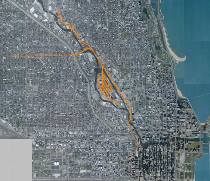
The dashed lines are not likely to be included... generally no switching.
Normal operations were based on a turn from Galewood Yard, located about 5.5 miles to the west (on the dashed line that runs to the left). I don't know how many jobs operated out of the yard on the island but I would image 60+ years ago it would have taken several each day.
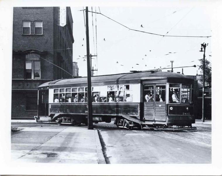
The MILW dieselized in Chicago fairly early, mostly Alco S-2's but there were also a few FM's and some 2-8-0's and 2-8-2's kept around too.
===========================================
So why Goose Island?
Well, I grew up on the north side of Chicago and every time we went downtown our route took us on the freeway that ran along the west side of the island. Between the car and the island was the 5-6 track mainline of the C&NW... then the river, which always meant bascule bridges, and the island nestled in with all sorts of industrial facilities. How could I not look every time? FWIW, the general atmosphere is captured here:
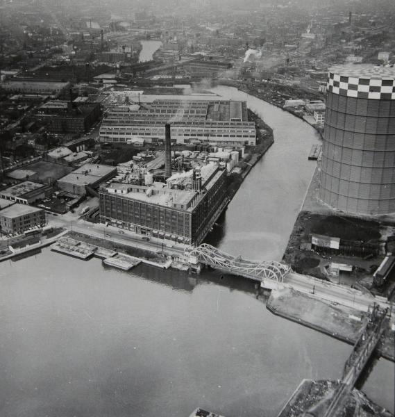
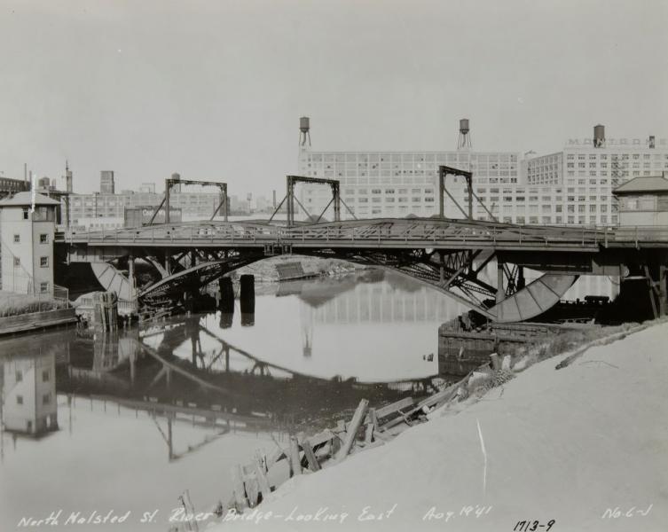
The MILW bridge to the island is in the lower right... and interesting contraption in its own right: it rotates from a pivot point on the north shore to clear for barges. Normally a rotating bridge pivots at the center... not this one tho. The bascule bridge for North Ave. is also seen... it splits in the center and each half rotates up from a pivot point on each end. If you don't know bascule bridges, here's one at the south end of the island:
Anyway, I mentioned some months ago in some thread here at ET that it was probably a good candidate for a tiny route and the more I thought about the curiouser I got about just how much work would it take. I looked at some maps, did a few rough measurements, and saw that most everything it needed fit in 4 tiles. Maybe 1 or 2 more going north and south, maybe a wider ring to put into some background... but the core only needed 4 tiles. Seemed do-able, especially if I don't fully develop the west shore area and the run to Galewood yard (5.5 miles of elevated track that runs thru residential neighborhoods).
So I pushed the Cal-P aside for a bit and started to work on this. Rather fun going back to square one. Rather frustrating at times too... I had forgotten just how rough it can be getting a route started.
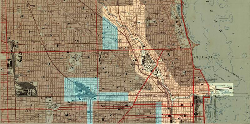
Once again I'm working from Sanborn Fire Insurance Maps and with the awful discover of the Kuju Skew in mind from the Cal-P's (right angled steets not falling on right angles because of the skew) I'm going about this route differently: Unlike the Cal-P, I de-skewed the terrain before doing anything else. Because the buildings are sized in the maps, the street grid has to be fairly accurate or things won't fit (a never ending problem on the Cal-P). So I'm placing the roads first, then the buildings (making road and building adjustments as needed to ensure the streets run in the right directions). I have a couple of more adjustments to make and then I think I might set down a bit of track -- taking my own advice I've offered to others: start in the middle so when I get tired of going one way I switch ends and go off in the other direction.
=========================
Will it get done?
Dunno. I'm enjoying working on something new. I've learnt a few things, including how to solve one problem on the Cal-P. I also gained what I think may be an important insight for the Open Rails project for an improved method of managing the contents of OR-Enhanced world files... so on the whole, it's been a good thing.
When I get some track in I'll make the route available to a few people for review and feedback. I figure mid October.
In the meanwhile I'll post a few other things about the route and site. I really don't know much about the MILW but I do know Chicago and at some level it's a bit of a home coming... feels good.